National Weather Service Warns of a Major ‘Coast to Coast’ Winter Storm
“A major winter storm will affect a large portion of the country this week. Heavy snow, sleet, and freezing rain is likely across the western and northern tier portions of the United States. Extreme impacts are likely, and historic snowfall is possible near Minneapolis, MN,” the NWS said in a social media update Tuesday of what has been dubbed “Winter Storm Olive.”
A major winter storm will affect a large portion of the country this week. Heavy snow, sleet, and freezing rain is likely across the western and northern tier portions of the United States. Extreme impacts are likely, and historic snowfall is possible near Minneapolis, MN. pic.twitter.com/28hULIrwj9
— NWS Weather Prediction Center (@NWSWPC) February 21, 2023
Why is Winter Storm #Olive going to be such an impactful snow storm?@mikebettes breaks it down ☟ pic.twitter.com/nJhcaUcDju
— Weather Underground (@wunderground) February 20, 2023
Winter Storm Olive is truly a coast to coast storm. Nearly 50 million people across the country have a winter alert that will impact them. 📈
Buckle up as this storm really gets into gear later today and tomorrow. ❄️@weatherchannel pic.twitter.com/5aXILBb5bG
— Veronica Dolan (@DolanWx) February 21, 2023
According to the NWS, the winter storm is expected to be “extremely disruptive” to travel.
“For portions of the High Plains to the Midwest, the combination of heavy snow rates of 1-2”/hr and strong wind gusts of 40-50 mph will create blizzard conditions,” it said, warning of “nearly impossible travel” as well as power outages.

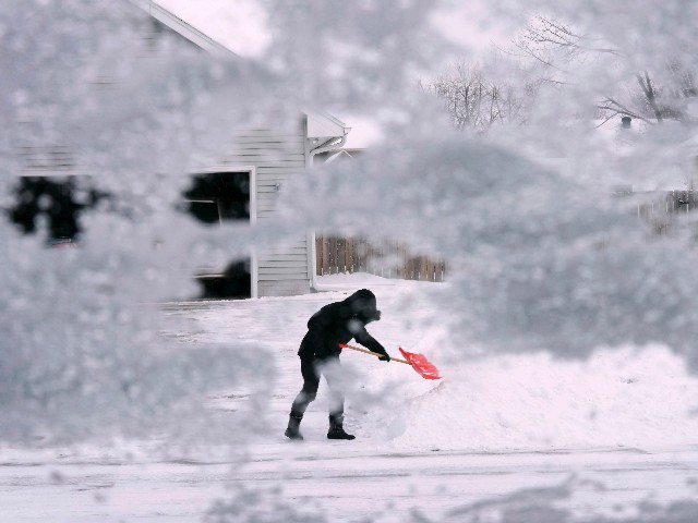
A local resident shovels snow off the end of a driveway, Thursday, Dec. 22, 2022, in Urbandale, Iowa. (Charlie Neibergall/AP)
Specifically, the NWS warns of:
…A major winter storm that will spread a large swath of heavy snow from the West Coast to the Northeast through Thursday; freezing rain forecast for the Lower Great Lakes…
…Widespread very strong, gusty winds expected across the West and adjacent High Plains…
…Heavy rain with the potential for scattered flash flooding and severe weather for the Midwest and Plains Wednesday…
…Widespread record-breaking highs possible in the East and much below average cold in the West beginning mid-week.
A report specifically for the Twin Cities warns the historic storm will be composed of “two rounds of snow totaling 1 to 2 feet of snow,” beginning Tuesday afternoon. It adds that this could break records held for well over 100 years:
Speaking historically, this event could very well break top five snowfalls in the Twin Cities dating back to 1884. The top event, a memorable one that seems to come up every year, was the Halloween Blizzard of 1991 with 28.4 inches of snow. Number two was a storm over Thanksgiving weekend in 1985 that amounted to 21.1 inches. Numbers three and four were in January of 1982, with totals of 20 and 17.4 inches respectively. To round out the top five and provide a more recent example, the Domebuster of 2010 with 17.1 inches.
The storm comes weeks after millions braced for the ice storm that swept the country, triggering dangerous travel conditions.


Comments are closed.