Hurricane Helene Upgraded to Category 2: Floridians Warned of ‘Unsurvivable’ Storm Surge, Vast Inland Damage
An “unsurvivable” storm surge is trailing in the wake of fast-moving Hurricane Helene as it barrels towards Florida. Damaging winds, rains, and flash floods hundreds of miles inland across much of the southeastern U.S. may also be in the mix, forecasters said Thursday.
AP reports Helene is now a major hurricane — meaning an upgrade to Category 2 — as it makes towards landfall on Florida’s northwestern Big Bend coast late Thursday evening and into Friday morning.
The storm is so large that areas roughly 90 miles north of the Georgia-Florida line could expect hurricane conditions. States as far inland as Tennessee, Kentucky and Indiana could see rainfall.
As of early Thursday, hurricane warnings and flash flood warnings extended far beyond the coast up into south-central Georgia. The governors of Florida, Georgia, and the Carolinas have all declared emergencies in their states.
The storm was expected to make landfall in the Big Bend region, where Florida’s panhandle and peninsula meet, according to Jack Beven, senior hurricane specialist at the National Hurricane Center in Miami, the AP report detailed.

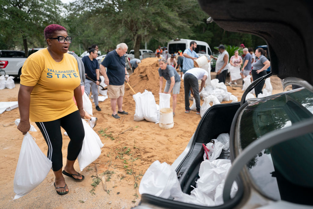
A resident takes sand bags to a car in preparation for possible flooding as Tropical Storm Helene heads toward the state’s Gulf Coast on September 25, 2024 in Tallahassee, Florida. Currently Helene is forecast to become a major hurricane, bringing the potential for deadly storm surges, flooding rain, and destructive hurricane-force winds along parts of the Florida West Coast. (Sean Rayford/Getty)
“Regardless of how strong it is, it is a very large storm,” Beven said. “It’s going to have impacts that cover a large area.”
The National Weather Service office in Tallahassee forecast storm surges of up to 20 feet and warned they could be particularly “catastrophic and unsurvivable” in Florida’s Apalachee Bay.
It added that high winds and heavy rains also posed risks, as Breitbart News reported.
Hurricane Watch: Hurricane Helene Ravages Beach on Cancun
“This forecast, if realized, is a nightmare surge scenario for Apalachee Bay,” the office said. “Please, please, please take any evacuation orders seriously!”
Florida Gov. Ron DeSantis has now issued a state of emergency for 61 of Florida’s 67 counties ahead of the storm’s landfall.
“Florida is preparing for widespread impacts from Hurricane Helene,” he said.


Comments are closed.