Brace for Impact: Floridians Warned Hurricane Milton Ready to Explode
Hurricane Milton is closing on Florida’s west coast with landfall expected as a Category 4 hurricane Wednesday night or early Thursday morning as a mass exodus continues. The extreme weather event will arrive as Floridians still work to recover from the devastation unleashed by Hurricane Helene’s impact 12 days ago.
AP reports almost the entirety of Florida’s west coast was under a hurricane warning early Tuesday as the storm and its 155 mph winds crept toward the state at nine mph, drawing energy from the Gulf of Mexico’s warm water.
In its 1 a.m. CDT Tuesday update, the National Hurricane Center (NHC) placed Milton just north of the Yucatan Peninsula and about 585 miles southwest of Tampa.
Residents have been ordered to evacuate from the storm’s path, as Tampa Mayor Jane Castor warned residents “there’s never been one like this.” She cautioned:
Hurricane Helene was a wake-up call, this is literally catastrophic. And I can say without any dramatization whatsoever: If you choose to stay in one of those evacuation areas, you’re going to die.
If you want to take on Mother Nature, she wins 100% of the time.
Earlier Monday, UPI notes Milton’s wind speeds had increased by 90 mph in less than 24 hours to 180 mph. It’s being called the third-fastest rapidly intensifying storm on record in the Atlantic, according to more than 40 years of National Hurricane Center data.

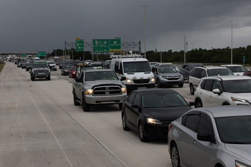
Traffic is heavy as thousands evacuate ahead of Hurricane Milton as it churns in the Gulf of Mexico on October 07, 2024, in St. Petersburg, Florida. Milton has strengthened as it approaches Florida’s Gulf Coast near St. Petersburg and Tampa, where it is projected to make landfall late Wednesday night. (Photo by Spencer Platt/Getty Images)
The strongest Atlantic hurricane on record is 1980’s Allen, which reached wind speeds of 190 mph as it moved through the Caribbean and Gulf before striking Texas and Mexico.
“This makes Milton one of the strongest hurricanes on record in the Atlantic Basin and the second strongest in the Gulf only behind Hurricane Rita in 2005 (895mb),” meteorologist Dylan Federico of Dallas’ KDFW-TV wrote in a Facebook post.
The storm was moving east at roughly nine mph, but is expected to increase in speed, forecasters said.

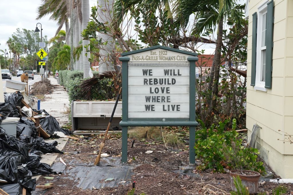
A sign is seen at the Pass-A-Grille Women’s Club in St. Petersburg, Florida, ahead of Hurricane Milton’s expected landfall in the middle of this week on October 7, 2024. (BRYAN R. SMITH/AFP via Getty Images)
“The center of Milton is forecast to move just north of the Yucatan Peninsula today and approach the west coast of the Florida Peninsula on Wednesday,” the NHC said. “The hurricane will likely make landfall in Florida Wednesday night.”
A storm surge watch was in effect for the Florida Gulf coast from Flamingo northward to the Suwannee River, including Charlotte Harbor and Tampa Bay.
Forecasters predicted late Monday that Tampa Bay could see a surge of between 10 and 15 feet.
Tampa Bay has not been hit directly by a major hurricane since 1921, and authorities fear luck is about to run out for the region and its 3,300,000 residents.


Comments are closed.